Boundary Surveys
Accurate Boundary Surveys Without the Hassle
Get a Free Quote From Us Today!
We aim to get back to you in 24 hours.
At Boundary Surveys, we provide accurate land measurement services designed to define and verify property boundaries with clarity and precision across the UK. Our specialist team reconciles physical markers on the ground with legal title deeds to ensure property limits are indisputable for land registry and planning purposes.
This expert service identifies exact ownership lines for property transactions and building projects, which prevents potential legal friction between neighbours and ensures that physical assets are correctly documented.
What Services Are Included In Boundary Surveys?
A variety of technical and research-based tasks are included in boundary surveys to ensure property lines are legally and physically confirmed:
- Title Plan Review – Analysing official land registry documents to establish the baseline for physical site measurements.
- Precision Site Mapping – Capturing the exact coordinates of all existing perimeter features like walls, hedges, and fences.
- Marker Installation – Placing permanent physical pins to provide visible evidence of the surveyed property limits on the ground.
- Legal Boundary Reports – Delivering a structured technical document that is defensible during property disputes or Land Registry applications.
- Encroachment Analysis – Identifying any areas where neighbouring structures or eaves overlap into your legal ownership area.
Where Are Boundary Surveys Required Across Properties?
You will find that boundary surveys are required for everything from domestic residential plots to large-scale commercial estates and agricultural land. The service is critical for developers planning new housing and for landowners wishing to formalise partition agreements before a sale.
By mapping these environments, the service ensures that structural extensions stay within legal limits, protecting the owner from future demolition orders or costly injunctions resulting from incorrect positioning.
How Much Do Boundary Surveys Cost?
The total professional fee for boundary surveys ranges from £400 to over £3,500, depending on the property size, the complexity of the boundary geometry, and the amount of historical research required.
Costs are primarily influenced by the time spent on-site for precision data capture and the density of physical features. Additional factors include the requirement for certified RICS reports, the need to resolve long-standing encroachment issues, and the difficulty of the terrain being mapped.
Contact Boundary Surveys to get customised prices for boundary surveys at your property.
Get a Free No Obligation Quotation Today
What Information And Features Are Identified In Boundary Surveys?
Our technical team identifies several critical site elements during boundary surveys to provide a complete picture of ownership limits:
- Ownership Perimeters – Defining the exact geometric limits of the property for official land registration purposes.
- Physical Demarcation – Documenting the position and type of all existing fences, walls, hedges, and boundary markers.
- Overlapping Discrepancies – Pinpointing areas where physical boundaries conflict with historic deeds or neighbouring property claims.
- National Grid Coordinates – Recording precise spatial data points that are geographically linked to the Ordnance Survey.
- Easement Locations – Mapping the locations of shared driveways, public footpaths, or recorded utility access rights.
When Should You Carry Out Boundary Surveys?
It is advisable to carry out boundary surveys before you exchange contracts on a land purchase or before starting any permanent wall or fence construction. Identifying boundary discrepancies early ensures that you do not inherit a legal liability or build over a neighbour's line.
Engaging our team early ensures your planning applications are based on fact, which prevents expensive litigation and ensures your project remains on a safe and predictable timeline.
How Does The Boundary Survey Process Work?
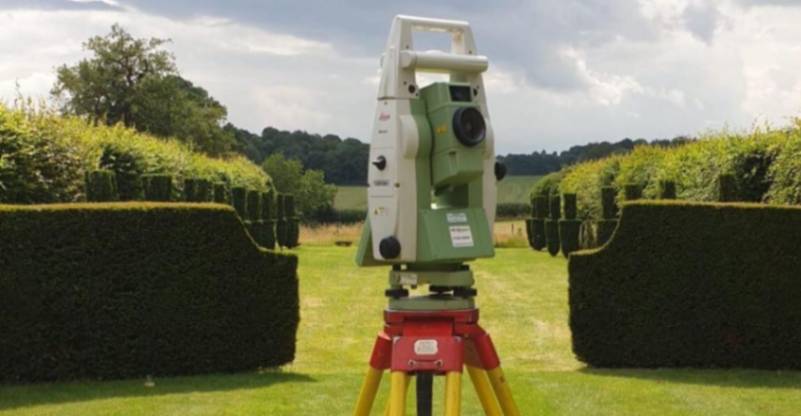
The technical process for our boundary surveys involves a sequence of deed analysis, electronic data capture, and meticulous drafting to ensure geospatial integrity. We begin by establishing geodetic control points that provide a fixed reference for all measurements relative to the national grid.
This process ensures that every marker is triangulated with absolute accuracy, resulting in a verifiable dataset that allows solicitors to draft accurate transfer deeds with total confidence.
Request a free quote
Which Property Owners And Projects Require Boundary Surveys?
A diverse range of stakeholders rely on boundary surveys to manage the legal and financial risks associated with land ownership, including homeowners and developers. Solicitors and legal professionals use the data to resolve title disputes, while architects require precise limits to maximise building footprints.
For agricultural landowners, the service is essential for managing large estates and ensuring that all land transactions are based on verified data.
Why Should You Choose Professional Boundary Survey Services?
Choosing our professional boundary surveys ensures that your land data is accurate and technically sound for legal and construction purposes. Qualified surveyors use regularly calibrated instrumentation that unvetted providers lack, which minimises the risk of building over boundaries.
This expert oversight maximises project efficiency, providing a clear audit trail and protecting your investment from the financial fallout of mapping errors or boundary encroachment claims.
How Quickly Can Boundary Surveys Be Completed?
The field work for boundary surveys can typically be completed within one to three days, depending on the scale and complexity of the terrain. Following the site visit, the digital processing phase takes an additional forty-eight hours to reconcile the data with historical records.
This efficiency ensures your conveyancing schedule remains on track, providing your team with the high-resolution plans needed to advance the project without unnecessary delays.
What Legal Standards And Regulations Apply To Boundary Surveys?
Every inspection for boundary surveys is conducted in strict accordance with the RICS Professional Statement for land measurement and current property law. Adhering to these standards ensures the delivery of reliable and legally compliant outputs that are technically sound for Land Registry applications.
Following these recognised industry codes provides the insurance-backed certainty that lenders demand, protecting the financial integrity of your property or infrastructure investment.
Contact Boundary Surveys for a consultation to get boundary surveys tailored to your organisation’s risks and responsibilities.
speak with our team today
What People are Saying About Us
★★★★★
"Professional boundary survey company with detailed drawings and excellent customer support throughout the entire process."
Ben Wilkins
London
★★★★★
"The survey was completed efficiently and the final plans were delivered quickly with all the detail we required."
Chloe Parsons
London
★★★★★
"Fantastic communication and reliable service from start to finish. The surveyors were knowledgeable and easy to deal with throughout."
Jacob Morris
London
★★★★★
"Highly impressed with the quality of the survey drawings and the professionalism shown by the team on site."
Katie Fletcher
London
Our Locations
We are proud to work nationally across the UK, allowing us to ensure we can provide services to you.
For a full list of counties we cover in the UK, see below.